Agulhas Biodiversity Initiative
  • HOME
  • What we do
    • Land-use planning
    • Responsible tourism
    • Environmental education
    • Green Economy
  • Partners
    • CAPE AGULHAS TOURISM
    • OVERBERG CRANE GROUP
    • NUWEJAARS WETLANDS SMA
    • WALKERBAY FYNBOS CONSERVANCY
    • FLOWER VALLEY CONSERVATION TRUST
    • OVERBERG DISTRICT MUNICIPALITY
    • GREATER OVERBERG FIRE PROTECTION ASSOCIATION
    • OVERBERG RENOSTERVELD CONSERVATION TRUST
    • BREEDE-GOURITZ CATCHMENT MANAGEMENT AGENCY
    • CAPENATURE
    • WWF–SA
    • ENVIRO – ED
    • DEPARTMENT OF ENVIRONMENT AFFAIRS
    • WHALE COAST CONSERVATION
    • DEPARTMENT OF AGRICULTURE: LANDCARE
    • TABLE MOUNTAIN FUND
    • SANPARKS
    • CONSERVATION AT WORK
    • GROOTBOS FOUNDATION
    • DOORNBOSCH GAME LODGE
    • OVERSTRAND MUNICIPALITY
    • FYNBOS TRUST
    • KHOI INDIGENOUS NATION TRADITIONAL ASSOCIATION
    • GROENLAND WATER USER ASSOCIATION
  • The Overberg
  • Blog
  • About us
    • ABI History
    • ABI Now
    • Governance
  • Research
  • Resources
  • Contact
  • Become a Member
Select Page
ABI meet: Agriculture and wildfire in the spotlight

ABI meet: Agriculture and wildfire in the spotlight

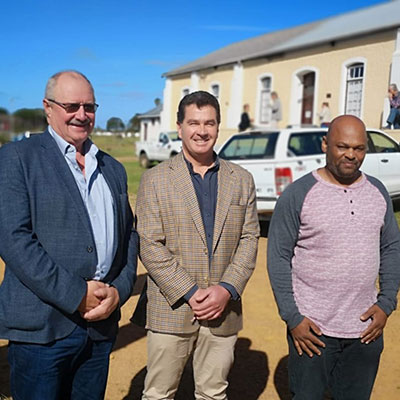
by Lesley Richardson | May 28, 2019 | Land-use planning

Most farmers in the Overberg practice conservation agriculture. Still, some practices in the Overberg are detrimental to the environment, including the illegal ploughing of virgin land. That’s the view of Acorn Agri & Food Chief Executive Officer, André Uys.

Overstrand Municipality: Fire & Rescue Services

Overstrand Municipality: Fire & Rescue Services

by Lesley Richardson | Mar 14, 2019 | Land-use planning

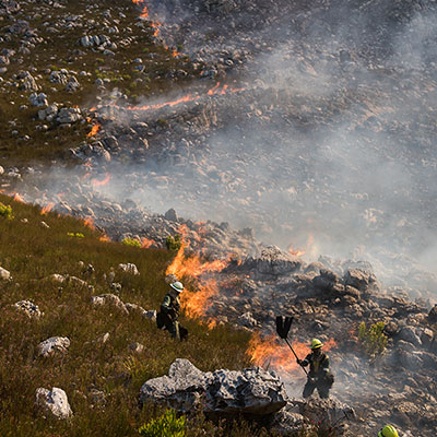
Few ABI members likely worked as hard as these members over the December/January holidays. The Overstrand Municipality Fire & Rescue Services were faced with a number of devastating wildfires. And they remain on high alert now (until at least

Mapping the Overberg: A critical planning tool

Mapping the Overberg: A critical planning tool

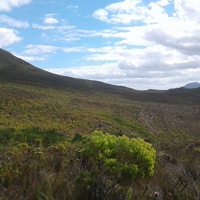
by Lesley Richardson | Mar 7, 2019 | Land-use planning

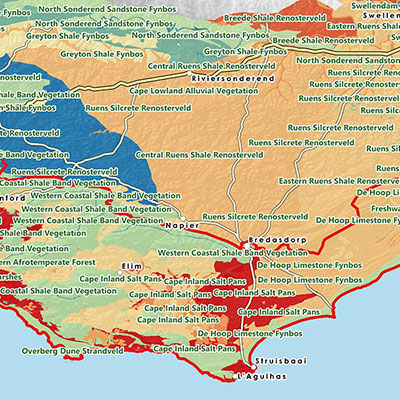
New tools and support allow the ABI team to track the impact of conservation partners working across the Overberg. This is being achieved through new mapping capacity. This is being achieved through new mapping capacity. Mapping is a critical

Minimising the impacts of fencing on birdlife

Minimising the impacts of fencing on birdlife

by Lesley Richardson | Nov 14, 2018 | Land-use planning

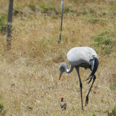
Fences are a major threat to South Africa’s birdlife. And the Overberg is no exception. Given the region’s strong agricultural focus, fences cover the landscape. But fences that aren’t well maintained, aren’t very visible, or are …

Get to know Grant, LandCare District Manager in the Overberg

Get to know Grant, LandCare District Manager in the Overberg

by Lesley Richardson | Sep 25, 2018 | Land-use planning

Growing up in Mitchell’s Plain, Grant Jepthas grew to love nature at a young age; as he learnt about the natural resources that the greater Cape area offers. And he soon…

Another win for nature through our Alien Clearing Project

Another win for nature through our Alien Clearing Project

by Lesley Richardson | Aug 6, 2018 | Land-use planning

Since the establishment of the Agulhas Biodiversity Initiative (ABI) in 2003, land-use planning has always been one of the major themes …

« Older Entries
Next Entries »

Recent Posts

  • Invasive aliens on front burner at historic ABI get-together
  • ABI Alien Clearing Project: The impact and challenges between 2013-2021
  • Regenerative SPACE Alien Plant Spotter Survey Tool

www.agulhasbiodiversity.co.za © 2012-2021. All Rights Reserved. Privacy Policy | Terms Website Use Photographs: Sharon Brink, Evan Eifler, LoveGreen. Website crafted with care and maintained by LoveGreen